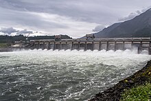
| Bonneville Locks and Dam | |
|---|---|
 Spillway structure | |
| Location | Columbia River Gorge National Scenic Area, Multnomah County, Oregon / Skamania County, Washington, United States |
| Coordinates | 45°38′39″N 121°56′26″W / 45.64417°N 121.94056°W |
| Construction began | 1934 (First Powerhouse) 1974 (Second Powerhouse) |
| Opening date | 1937 (First Powerhouse) 1981 (Second Powerhouse) |
| Construction cost | $88.4 million (First Powerhouse, Spillway, Lock and Fish structures) $664 million (Second Powerhouse) |
| Owner(s) | US Army Corps of Engineers (Operator) Bonneville Power Administration (Marketer) |
| Dam and spillways | |
| Type of dam | Concrete gravity, run-of-the-river |
| Impounds | Columbia River |
| Height | 171 ft (52 m)[1] |
| Length | 2,690 ft (820 m) |
| Width (base) | 132 ft (40 m) (Spillway) |
| Spillway type | Service, gate-controlled |
| Reservoir | |
| Creates | Lake Bonneville |
| Total capacity | 537,000 acre⋅ft (0.662 km3) |
| Catchment area | 240,000 sq mi (620,000 km2) |
| Power Station | |
| Turbines | 20 and unit 0 |
| Installed capacity | 1242 MW[2] |
| Annual generation | 4,466 GWh (2009)[3] |
Bonneville Dam Historic District | |
| Location | Bonneville, Oregon |
| Built | 1934–1943 |
| Architect | Claussen and Claussen |
| Architectural style | Colonial Revival |
| NRHP reference No. | 86000727 (original) 86003598 (increase) |
| Significant dates | |
| Added to NRHP | April 9, 1986 |
| Boundary increase | March 26, 1987[4] |
| Designated NHLD | June 30, 1987[5] |
Bonneville Lock and Dam /ˈbɒnəvɪl/ consists of several run-of-the-river dam structures that together complete a span of the Columbia River between the U.S. states of Oregon and Washington at River Mile 146.1.[6] The dam is located 40 miles (64 km) east of Portland, Oregon, in the Columbia River Gorge. The primary functions of Bonneville Lock and Dam are electrical power generation and river navigation. The dam was built and is managed by the United States Army Corps of Engineers. At the time of its construction in the 1930s it was the largest water impoundment project of its type in the nation, able to withstand flooding on an unprecedented scale.[7] Electrical power generated at Bonneville is distributed by the Bonneville Power Administration. Bonneville Dam is named for Army Capt. Benjamin Bonneville, an early explorer credited with charting much of the Oregon Trail. The Bonneville Dam Historic District was designated a National Historic Landmark District in 1987.[5]
- ^ "Bonneville Dam and Lake Bonneville".
- ^ Cite error: The named reference
BonnevilleBrochurewas invoked but never defined (see the help page). - ^ "Bonneville". Carbon Monitoring for Action (CARMA). Retrieved August 13, 2016.
- ^ "National Register Information System". National Register of Historic Places. National Park Service. January 23, 2007.
- ^ a b "Bonneville Dam Historic District". National Historic Landmark summary listing. National Park Service. Archived from the original on January 6, 2008. Retrieved November 18, 2007.
- ^ "The Columbia River System Inside Story" (PDF). BPA.gov. pp. 14–15. Archived from the original (PDF) on May 27, 2010. Retrieved July 17, 2010.
- ^ Cite error: The named reference
nrhpinv2was invoked but never defined (see the help page).