| Bonneville Salt Flats | |
|---|---|
 Sunset at the Bonneville Salt Flats in 2015. Unique hexagon patterns are formed by the freezing and thawing of brackish waters. | |
| Floor elevation | 1,291 m (4,236 ft) |
| Length | 12 mi (19 km) |
| Width | 5 mi (8.0 km) |
| Area | 40 sq mi (100 km2) [1] |
| Geography | |
| Country | United States |
| State | Utah |
| County | Tooele |
| Borders on | Interstate 80 in Utah (south) West Wendover, Nevada (west) |
| Coordinates | 40°47′59″N 113°48′00″W / 40.79972°N 113.80000°W |
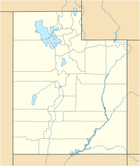
The Bonneville Salt Flats are a densely packed salt pan in Tooele County in northwestern Utah, United States. A remnant of the Pleistocene Lake Bonneville, it is the largest of many salt flats west of the Great Salt Lake. It is public land managed by the Bureau of Land Management and is known for land speed records at the Bonneville Speedway. Access to the Flats is open to the public.
The Flats are about 12 miles (19 km) long and 5 miles (8 km) wide, with a crust almost 5 ft (1.5m) thick at the center and less than one inch (2.5 cm) towards the edges. It is estimated to hold 147 million tons of salt, approximately 90% of which is common table salt.[2]
- ^ Lines, Gregory C (1979). Hydrology and surface morphology of the Bonneville Salt Flats and Pilot Valley Playa, Utah. Archived from the original on 2010-06-21. Retrieved 2010-05-28.
- ^ Cite error: The named reference
blmbsfwas invoked but never defined (see the help page).
