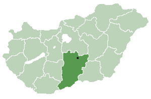
Borota | |
|---|---|
Municipality | |
| Coordinates: 46°16′00″N 19°14′00″E / 46.266667°N 19.233333°E | |
| Country | |
| County | Bács-Kiskun |
| Government | |
| • Type | Mayor-council government |
| • Mayor | Ferencné Mikó (Ind.) |
| Area | |
| • Total | 81.8 km2 (31.6 sq mi) |
| Population (2018)[2] | |
| • Total | 1,309 |
| • Density | 16/km2 (41/sq mi) |
| Time zone | UTC+1 (CET) |
| • Summer (DST) | UTC+2 (CEST) |
| Postal code | 6445 |
| Area code | 77 |
| Geocode | 19327 |
| Year | Pop. | ±% |
|---|---|---|
| 1961 | 3,684 | — |
| 1971 | 2,680 | −27.3% |
| 1981 | 2,149 | −19.8% |
| 1991 | 1,743 | −18.9% |
| 2001 | 1,592 | −8.7% |
| 2011 | 1,409 | −11.5% |
| 2018 | 1,309 | −7.1% |
| Source: Eurostat | ||

Borota is a village and municipality (Hungarian: község) in Bács-Kiskun county, located in the Southern Great Plain region of Hungary.
- ^ "Borota települési választás eredményei" (in Hungarian).
- ^ a b Cite error: The named reference
refpopwas invoked but never defined (see the help page).

