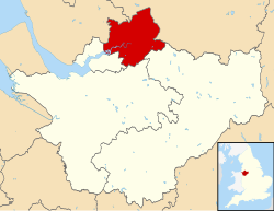
The Borough of Warrington is a unitary authority area with borough status in the ceremonial county of Cheshire, England. The borough is centred around the town of Warrington, and extends out into outlying villages of Lymm and Great Sankey and the town of Birchwood.
The borough is geographically located to the north and northeast of the Cheshire West and Chester and Halton districts in Cheshire, the metropolitan borough of St Helens in Merseyside to the northwest and north and the metropolitan boroughs of Wigan and Trafford in Greater Manchester to the northeast, east, and southeast. Additionally, to the south-east, the borough borders Cheshire East. The borough is also located between the cities of Liverpool, Salford, Manchester, Chester and Preston. The district straddles the historic counties of Cheshire (the southern part of the district includes Lymm and Stockton Heath) and Lancashire (the northern part including Warrington itself and Latchford).
- ^ "Democracy, elections and civic". Warrington Borough Council. Retrieved 18 December 2023.
- ^ "Mid-Year Population Estimates, UK, June 2022". Office for National Statistics. 26 March 2024. Retrieved 3 May 2024.
- ^ "Mid-Year Population Estimates, UK, June 2022". Office for National Statistics. 26 March 2024. Retrieved 3 May 2024.
- ^ a b UK Census (2021). "2021 Census Area Profile – Warrington Local Authority (E06000007)". Nomis. Office for National Statistics. Retrieved 18 December 2023.

