Botafogo | |
|---|---|
Neighborhood | |
 | |
| Coordinates: 22°57′0″S 43°11′3″W / 22.95000°S 43.18417°W | |
| Country | |
| State | Rio de Janeiro (RJ) |
| Municipality/City | Rio de Janeiro |
| Zone | South Zone |
| Administrative Region | Botafogo |
| Area | |
• Total | 4.8 km2 (1.9 sq mi) |
| Population (2010)[1] | |
• Total | 82,890 |
| • Density | 17,000/km2 (45,000/sq mi) |
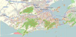
Botafogo (local/standard Portuguese pronunciation: [bɔtaˈfoɡu] alternative Brazilian Portuguese pronunciation: [botɐˈfoɡu]) is a beachfront neighborhood (bairro) in Rio de Janeiro, Brazil. It is a mostly upper middle class and small commerce community, and is located between the hills of Mundo Novo, Dona Marta (which separates it from Laranjeiras) and São João (which separates it from Copacabana). The word Botafogo also refers to a Latin American ballroom dance move that originated in this area.
- ^ "Bairro: Botafogo" (in Portuguese). Prefeitura da Cidade do Rio de Janeiro. Archived from the original on 13 October 2014. Retrieved 8 October 2014.

