This article includes a list of references, related reading, or external links, but its sources remain unclear because it lacks inline citations. (September 2018) |
| Brahmagiri | |
|---|---|
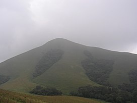
 Brahmagiri. Mountain peak covered with fog. | |
| Highest point | |
| Elevation | 1,608 m (5,276 ft) |
| Coordinates | 11°57′N 75°57′E / 11.950°N 75.950°E |
| Geography | |
Border of Mananthavady Taluk, Wayanad District, Kerala and Virajpet Taluk, Kodagu district, Karnataka, India | |
| Parent range | Western Ghats |
| Climbing | |
| Easiest route | Hike |
Brahmagiri, is a mountain range in the Western Ghats of south India. It is situated on the border between Kodagu district in Karnataka state in the north and Wayanad district of Kerala state on the south. Brahmagiri Hill, at 1608 m height, near Tirunelli is a scenic tourist attraction. The top of Brahmagiri Hill is well forested and has much wildlife. Talakaveri is located on the northern section of the range, near Bhagamandala in Kodagu district (Coorg), in the South Indian state of Karnataka.


