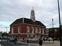
| Braintree | |
|---|---|
 | |
Location within Essex | |
| Population | 43,215 (2021 Census)[1] |
| OS grid reference | TL7522 |
| District | |
| Shire county | |
| Region | |
| Country | England |
| Sovereign state | United Kingdom |
| Post town | BRAINTREE |
| Postcode district | CM7, CM77 |
| Dialling code | 01376 |
| Police | Essex |
| Fire | Essex |
| Ambulance | East of England |
| UK Parliament | |
Braintree is a town in Essex, England, and is the principal settlement of Braintree District. It is located 10 miles (16 km) north-east of Chelmsford, 15 miles (24 km) west of Colchester and 35 miles (56 km) north-west of Southend-on-Sea. According to the 2021 Census, the town had a population of 43,492; the urban area, which includes Great Notley, Rayne, Tye Green and High Garrett, had a population of 55,793.[2]
Braintree district has four market towns, picturesque villages, a designer shopping outlet, historic houses and gardens.
The town has grown contiguously with several surrounding settlements. The original settlement and parish of Braintree lay on the River Brain and was bounded on the north by Stane Street, the Roman road from Braughing to Colchester. North of that road was the parish of Bocking. The two parishes were united in 1934 as the parish and urban district of Braintree and Bocking, which was subsequently abolished in 1974 when the modern Braintree District was created. Several local organisations still include Braintree and Bocking in their names.[nb 1]
Braintree is bypassed by the modern-day A120 and A131 roads, while trains serve two stations in the town, at the end of the Braintree Branch Line from Witham.
The town is twinned with Pierrefitte-sur-Seine, France,[3] and gives its name to the towns of Braintree, Massachusetts and Braintree, Vermont, in the United States.[3]
- ^ "Braintree". City population. Retrieved 25 October 2022.
- ^ East of England. Braintree citypopulation.de
- ^ a b Cite error: The named reference
EL65-67was invoked but never defined (see the help page).
Cite error: There are <ref group=nb> tags on this page, but the references will not show without a {{reflist|group=nb}} template (see the help page).
