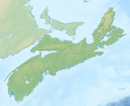
| Bras d'Or Lake Pitupaq | |
|---|---|
 | |
| Location | Cape Breton Island, Nova Scotia |
| Coordinates | 45°51′37″N 60°46′44″W / 45.86028°N 60.77889°W |
| Type | estuary |
| Primary outflows | Gulf of St. Lawrence Atlantic Ocean |
| Basin countries | Canada |
| Max. length | 100 km (62 mi) |
| Max. width | 50 km (31 mi) |
| Surface area | 1,099 km2 (424 sq mi) |
| Max. depth | 287 m (942 ft) |
| Water volume | 32,000,000,000 m3 (4.2×10¹⁰ cu yd)[1] |
| Shore length1 | 1,000 km (621 mi) (excluding islands)[1] |
| Surface elevation | 0 m (0 ft) (sea level) |
| 1 Shore length is not a well-defined measure. | |
Bras d'Or Lake (Mi'kmawi'simk: Pitupaq) is an irregular estuary in the centre of Cape Breton Island in Nova Scotia, Canada.[2] It has a connection to the open sea, and is tidal. It also has inflows of fresh water from rivers, making the brackish water a very productive natural habitat. It was designated the Bras d'Or Lake Biosphere Reserve by UNESCO in 2011.[3]
- ^ a b "Canadian Technical Report of Hydrography and Ocean Sciences 230 – Modelling the tides of the Bras d'Or Lakes" (PDF). Department of Fisheries and Oceans – 2003. Archived (PDF) from the original on 23 April 2013. Retrieved 24 April 2012.
- ^ Chisholm, Hugh, ed. (1911). . Encyclopædia Britannica (11th ed.). Cambridge University Press.
- ^ "UNESCO Biosphere". UNESCO. Archived from the original on 1 September 2011. Retrieved 10 September 2011.
