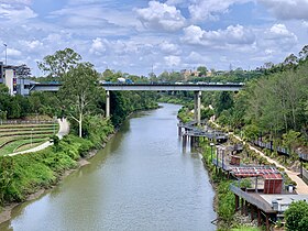
| Bremer River Urarrar (Red Stemmed Gum Trees in Ugarapul ) | |
|---|---|
 Road bridge across the Bremer River in Ipswich | |
Location of Bremer River river mouth in Queensland | |
| Etymology | Captain Gordon Bremer[1] |
| Location | |
| Country | Australia |
| State | Queensland |
| Region | Scenic Rim, South East Queensland |
| Cities | Ipswich, Brisbane |
| Physical characteristics | |
| Source | Scenic Rim |
| • location | Main Range National Park |
| • coordinates | 27°55′55″S 152°27′53″E / 27.93194°S 152.46472°E |
| • elevation | 140 m (460 ft) |
| Mouth | confluence with the Brisbane River |
• location | Barellan Point |
• coordinates | 27°34′57″S 152°51′16″E / 27.58250°S 152.85444°E |
• elevation | 4 m (13 ft) |
| Length | 100 km (62 mi) |
| Basin size | 2,032 km2 (785 sq mi) |
| Basin features | |
| River system | Brisbane River catchment |
| Tributaries | |
| • left | Western Creek, Franklin Vale Creek |
| • right | Warrill Creek, Reynold Creek, Purga Creek, Deebing Creek, Bundamba Creek |
| National park | Main Range National Park |
| [2] | |
The Bremer River is a river that is a tributary of the Brisbane River, located in the Scenic Rim and Brisbane regions of South East Queensland, Australia. The 100-kilometre (62 mi)-long Bremer River drains several Scenic Rim valleys in south-east Queensland, including the Fassifern Valley, with its catchment area covering approximately 2,032 square kilometres (785 sq mi).[3] Most valleys within the catchment have extensive river terraces. The Bremer River system is extremely degraded.
European explorers John Oxley and Allan Cunningham visited the river in 1824 and it was first named by Oxley as Bremer's Creek presumably after Captain Gordon Bremer who was in charge of HMS Tamar, at that time performing duties in the waters of the colony of New South Wales.[1]
- ^ a b "Ipswich - Culture and History". The Age. Archived from the original on 4 November 2012. Retrieved 8 December 2009.
- ^ "Map of Bremer River, QLD". Bonzle Digital Atlas of Australia. Archived from the original on 13 January 2016. Retrieved 24 September 2015.
- ^ Strategic Guide to Natural Resource Management in South East Queensland. South East Queensland Regional Strategic Group. November 2000. p. 105. ISBN 0-7345-1740-8.
