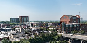
Brewery District | |
|---|---|
 | |
 Interactive map of the neighborhood | |
| Coordinates: 39°58′09″N 83°00′22″W / 39.969270°N 83.006039°W | |
| Country | United States |
| State | Ohio |
| County | Franklin |
| City | Columbus |
| ZIP Code | 43206, 43215 |
| Area code | 614 |
The Brewery District, traditionally known as the Old German Brewing District,[1] is a neighborhood located in Columbus, Ohio. Located just south of the central business district and west of German Village, it is bounded by Interstate 70 on the north, South Pearl Street on the east, Greenlawn Avenue on the south, and the Scioto River on the west.[2]
- ^ "The Brewery District Plan" (PDF). Columbus.gov. Columbus Planning Commission. Retrieved 2 December 2014.
- ^ "Brewery District". touring-ohio.com. Ohio City Productions. Archived from the original on 14 October 2014. Retrieved 2 December 2014.