| Brixentaler Ache | |
|---|---|
 The diagram shows the tributaries coming from the south, the Kelchsauer Ache (blue highlights) and Windauer Ache (red highlights); the Brixentaler Ache (orange) rises as the Brixenbach (violet) in Brixen im Thale and empties in Wörgl into the Inn. The catchment area of the Brixentaler Ache is shaded in yellow. | |
 | |
| Location | |
| Country | Austria |
| State | Tyrol |
| Districts | Kufstein and Kitzbühel |
| Physical characteristics | |
| Source | |
| • location | Einködlscharte on the mountain Gampenkogel in Brixen im Thale |
| • coordinates | 47°24′09″N 12°15′21″E / 47.40250°N 12.25583°E |
| • elevation | 1,700 m (AA) |
| Mouth | |
• location | near Wörgl into the Inn |
• coordinates | 47°29′59″N 12°03′33″E / 47.49972°N 12.05917°E |
• elevation | 500 m (AA) |
| Length | 26.4 km (16.4 mi) [1] |
| Basin size | 329 km2 (127 sq mi) [1] |
| Basin features | |
| Progression | Inn→ Danube→ Black Sea |
| Landmarks |
|
| Population | ca. 14,000 |
| Tributaries | |
| • left | Windauer Ache, Kelchsauer Ache |
| Navigable | not navigable |
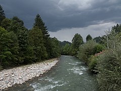
The Brixentaler Ache is a river of Tyrol, Austria, a right tributary of the Inn. It passes through the districts of Kitzbühel and Kufstein. It is one of the largest tributaries of the Inn in the Tyrolean Unterland by catchment area (329 km2 (127 sq mi)), but is only 26.4 km (16.4 mi) long.[1]
