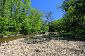
| Bronte Creek Provincial Park | |
|---|---|
 Bronte Creek shoreline | |
Location in Southern Ontario | |
| Location | Ontario, Canada |
| Nearest city | Oakville, Ontario |
| Coordinates | 43°24′50″N 79°46′0″W / 43.41389°N 79.76667°W |
| Area | 6.4 km2 (2.5 sq mi) |
| Established | 1975 |
| Visitors | 290,727 (in 2022[2]) |
| Governing body | Ontario Parks |
| Website | ontarioparks |
 | |
Bronte Creek Provincial Park is located in Oakville, Ontario, Canada, and is part of the Ontario Parks system.
The 6.4-square-kilometre (2.5 sq mi) park is located at the western edge of Oakville, bordering on Burlington. The park features hiking and biking trails, cross country skiing, and a play barn. During the summer, swimming is available in a large outdoor swimming pool.(Pool Temporarily Closed)[3] Camping in the park is permitted, including sites with electrical hookups.[3]
Bronte Creek Provincial Park has two separate activity areas (day-use and camping) which must be accessed via two separate entrances. Campground must be accessed via 3201 Upper Middle Road W, Oakville. This is off of Bronte Road, exit 111 off the QEW/ 403. The main day-use area is accessed via 1219 Burloak Drive, Oakville. (exit 109 off the QEW/ 403).
- ^ UNEP-WCMC. "Protected Area Profile for Bronte Creek Provincial Park". World Database on Protected Areas. Retrieved 2024-11-02.
- ^ Parks, Ontario. "Ontario_Parks-Visitation-Statistics 2022 - Ministries". data.ontario.ca. Retrieved 2024-11-02.
- ^ a b "Bronte Creek Provincial Park". Toronto Life. Archived from the original on 2008-12-02. Retrieved 14 January 2010.
