Brus
Брус (Serbian) | |
|---|---|
Town and municipality | |
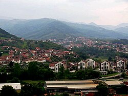
 Panoramic view of Brus | |
 Location of the municipality of Brus within Serbia | |
| Coordinates: 43°22′53″N 21°02′16″E / 43.38139°N 21.03778°E | |
| Country | |
| Region | Šumadija and Western Serbia |
| District | Rasina |
| Settlements | 58 |
| Government | |
| • Mayor | Dalibor Savić (SNS) |
| Area | |
| • Town | 2.71 km2 (1.05 sq mi) |
| • Municipality | 606 km2 (234 sq mi) |
| Elevation | 436 m (1,430 ft) |
| Population (2022 census)[2] | |
| • Town | 4,183 |
| • Town density | 1,500/km2 (4,000/sq mi) |
| • Municipality | 13,594 |
| • Municipality density | 22/km2 (58/sq mi) |
| Time zone | UTC+1 (CET) |
| • Summer (DST) | UTC+2 (CEST) |
| Postal code | 37220 |
| Area code | +381(0)37 |
| Car plates | KŠ |
| Website | www |
Brus (Serbian Cyrillic: Брус, pronounced [brûːs]) is a town and municipality located in the Rasina District of southern Serbia. According to the 2022 census, the population of the town is 4,183, while the population of the municipality is 13,594. It is located at 430 metres (1,410 ft) above sea level, just below the Kopaonik ski resort. The city is surrounded by hills on three levels, where the lowest one is a place where the Grasevka river firths into the Rasina river. On the upper level of the town, a fountain of medicinal mineral water is located.
- ^ "Municipalities of Serbia, 2006". Statistical Office of Serbia. Retrieved 2010-11-28.
- ^ "Census 2022: Total population, by municipalities and cities". popis2022.stat.gov.rs.
