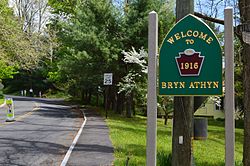
Borough of Bryn Athyn | |
|---|---|
 | |
 Location of Bryn Athyn in Montgomery County, Pennsylvania. | |
| Coordinates: 40°08′22″N 75°04′02″W / 40.13944°N 75.06722°W | |
| Country | United States |
| State | Pennsylvania |
| County | Montgomery |
| Incorporated | 1916 |
| Government | |
| • Type | Council-manager |
| • Mayor | Kenneth Schauder |
| Area | |
| • Total | 1.93 sq mi (5.00 km2) |
| • Land | 1.93 sq mi (5.00 km2) |
| • Water | 0.00 sq mi (0.00 km2) |
| Elevation | 292 ft (89 m) |
| Population | |
| • Total | 1,272 |
| • Density | 658.73/sq mi (254.32/km2) |
| Time zone | UTC-5 (EST) |
| • Summer (DST) | UTC-4 (EDT) |
| ZIP Code | 19009 |
| Area code(s) | 215, 267, and 445 |
| FIPS code | 42-09696 |
| Website | http://www.brynathynboro.org |
Bryn Athyn is a home rule municipality in Montgomery County, Pennsylvania. It was formerly a borough, and its official name remains "Borough of Bryn Athyn". The population was 1,375 at the 2010 census. It was formed for religious reasons from Moreland Township on February 8, 1916. Bryn Athyn is surrounded by Lower Moreland Township.[3]
"Bryn Athyn" was intended to mean "Hill of Unity" by its founders. "Bryn" is Welsh for "hill"; the source of "athyn" is unclear.[4][5]
Bryn Athyn is located 60.1 miles (96.7 km) southeast of Allentown and 19.9 miles (32.0 km) north of Philadelphia.
- ^ "ArcGIS REST Services Directory". United States Census Bureau. Retrieved October 12, 2022.
- ^ Cite error: The named reference
USCensusDecennial2020CenPopScriptOnlywas invoked but never defined (see the help page). - ^ "commerce: Fact Sheets - Bryn Athyn Borough". Montgomery County, Pennsylvania. 2006-12-20. Archived from the original on 2008-07-23. Retrieved 2007-09-27.
- ^ Gyllenhaal, Ed and Kirsten. "The Naming of Bryn Athyn (1899)". New Church History Fun Facts. Retrieved 2016-05-22.
- ^ "Geiriadur Prifysgol Cymru (University of Wales Dictionary)". Retrieved 2016-05-22.

