| Buford Dam | |
|---|---|
 | |
| Country | United States |
| Location | Buford, Georgia |
| Coordinates | 34°09′37″N 84°04′26″W / 34.16028°N 84.07389°W |
| Purpose | Multi-purpose |
| Status | Operational |
| Construction began | March 1, 1950 |
| Opening date | October 9, 1957 |
| Operator(s) | United States Army Corps of Engineers |
| Dam and spillways | |
| Type of dam | Earth fill dam |
| Impounds | Chattahoochee River |
| Height (thalweg) | 192 ft (59 m)[1] |
| Length | 1,630 ft (500 m)[2] |
| Width (crest) | 40 ft (12 m)[2] |
| Width (base) | 1,000 ft (300 m)[2] |
| Spillways | 1[2] |
| Spillway type | Uncontrolled chute[2] |
| Reservoir | |
| Creates | Lake Lanier |
| Commission date | 1958[3] |
| Annual generation | 250 GWh |
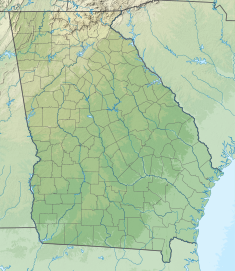
Buford Dam is a dam in Buford, Georgia which is located at the southern end of Lake Lanier,[4] a reservoir formed by the construction of the dam in 1956. The dam itself is managed by the United States Army Corps of Engineers.
The dam is made of earth and concrete,[5] supplemented by three saddle dikes,[1] and was built to provide a water source for the Atlanta area, power homes, and prevent flooding of the Chattahoochee River.[6][7]
Electricity from the dam is marketed by the Southeastern Power Administration.[8]
- ^ a b United States. Army. Corps of Engineers (1975). Buford Dam and Lake Sidney Lanier Flood Control, Navigation, Power: Environmental Impact Statement (Report). Archived from the original on September 7, 2022. Retrieved August 19, 2022.
- ^ a b c d e "Buford Dam – Chattahoochee River, Georgia – Pertinent Data". janandpat.net. Archived from the original on April 26, 2017. Retrieved August 19, 2022.
- ^ "Hydropower Facilities". United States Army Corps of Engineers. Archived from the original on April 22, 2021. Retrieved August 19, 2022.
- ^ "Buford Dam Park on Lake Lanier". September 23, 2019. Archived from the original on August 18, 2022. Retrieved August 18, 2022.
- ^ Cite error: The named reference
cookwas invoked but never defined (see the help page). - ^ Cite error: The named reference
kernswas invoked but never defined (see the help page). - ^ Collier, Michael; Webb, Robert H.; Schmidt, John C. (2000). Dams and Rivers A Primer on the Downstream Effects of Dams. U.S. Geological Survey, Branch of Information Services. p. 39. ISBN 9780788126987. Archived from the original on September 7, 2022. Retrieved August 19, 2022.
- ^ "Generation – Southeastern Power Administration". Energy.gov. Retrieved March 20, 2023.

