 A satellite picture of Freetown, 2006. | |
| Geography | |
|---|---|
| Location | Sierra Leone River |
| Coordinates | 8°34′N 13°02′W / 8.567°N 13.033°W |
| Administration | |
| Additional information | |
| Time zone | |
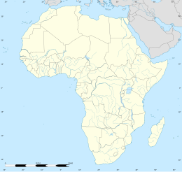
Bunce Island (also spelled "Bence," "Bense," or "Bance" at different periods) is an island in the Sierra Leone River. It is situated in Freetown Harbour, the estuary of the Rokel River and Port Loko Creek, about 20 miles (32 kilometres) upriver from Sierra Leone's capital city Freetown. The island measures about 1,650 feet (502.9 metres) by 350 feet (106.7 metres) and houses a castle that was built by the Royal Africa Company in c.1670. Tens of thousands of Africans were shipped from here to the North American colonies of South Carolina and Georgia to be forced into slavery, and are the ancestors of many African Americans of the United States.[1]
Although the island is small, its strategic position at the limit of navigation for ocean-going ships in Africa's largest natural harbour made it an ideal base for European slave traders.[2][3] To mark the 2007–2008 bicentennial of Britain's abolition of the slave trade, a team at James Madison University created a three-dimensional animation of the castle as it was in 1805, and an exhibit on the site that was displayed to museums all across the U.S. which is now held by the Sierra Leone National Museum.[4]
- ^ "Bunce Island History". Yale Macmillan Center. Gilder Lehrman Center for the Study of Slavery, Resistance, and Abolition. Retrieved 28 February 2024.
- ^ Duthiers, Vladimir; Kermeliotis, Teo (16 May 2013). "'Slave trade ghost town': The dark history of Bunce Island". edition.cnn.com. CNN.com. Retrieved 9 April 2016.
- ^ "A closer look at Bunce Island". World Monuments Fund. 8 April 2016.
- ^ "Bunce Island: A British Slave Castle in Sierra Leone", Official website, Bunce Island exhibit, accessed 25 February 2014.
