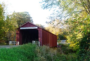
Bureau County | |
|---|---|
 Red Covered Bridge (1863) | |
 Location within the U.S. state of Illinois | |
 Illinois's location within the U.S. | |
| Coordinates: 41°25′N 89°32′W / 41.41°N 89.53°W | |
| Country | |
| State | |
| Founded | 1837 |
| Seat | Princeton |
| Largest city | Princeton |
| Area | |
| • Total | 874 sq mi (2,260 km2) |
| • Land | 869 sq mi (2,250 km2) |
| • Water | 4.5 sq mi (12 km2) 0.5% |
| Population (2020) | |
| • Total | 33,244 |
| • Estimate (2023) | 32,729 |
| • Density | 38/sq mi (15/km2) |
| Time zone | UTC−6 (Central) |
| • Summer (DST) | UTC−5 (CDT) |
| Congressional districts | 14th, 16th |
| Website | bureaucounty-il |
Bureau County is a county located in the U.S. state of Illinois. As of the 2020 United States Census, the population was 33,244.[1] Its county seat is Princeton.[2] Bureau County is part of the Ottawa, IL Micropolitan Statistical Area, and the Hennepin Canal Parkway State Park is located partly in this county.
- ^ "State & County QuickFacts". United States Census Bureau. Retrieved January 23, 2023.
- ^ "Find a County". National Association of Counties. Archived from the original on May 31, 2011. Retrieved June 7, 2011.