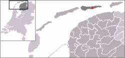
Buren | |
|---|---|
Village | |
 Buren | |
 Location in Ameland municipality | |
Location in the province of Friesland | |
| Coordinates: 53°26′50″N 5°47′56″E / 53.44722°N 5.79889°E | |
| Country | |
| Province | |
| Municipality | |
| Area | |
| • Total | 21.43 km2 (8.27 sq mi) |
| Elevation | 3.7 m (12.1 ft) |
| Population (2021)[1] | |
| • Total | 740 |
| • Density | 35/km2 (89/sq mi) |
| Time zone | UTC+1 (CET) |
| • Summer (DST) | UTC+2 (CEST) |
| Postal code | 9164 |
| Dialing code | 0519 |
Buren is the easternmost village on the island of Ameland, one of the West Frisian Islands and part of the Netherlands. Buren had, as of January 2017, a population of 715.[3]
- ^ a b "Kerncijfers wijken en buurten 2021". Central Bureau of Statistics. Retrieved 26 April 2022.
- ^ "Postcodetool for 9164KA". Actueel Hoogtebestand Nederland (in Dutch). Het Waterschapshuis. Retrieved 26 April 2022.
- ^ Kerncijfers wijken en buurten 2017 - CBS (in Dutch)

