Burlingame | |
|---|---|
| City of Burlingame | |
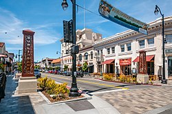
 Burlingame Avenue | |
 Location of Burlingame in San Mateo County, California | |
| Coordinates: 37°35′0″N 122°21′49″W / 37.58333°N 122.36361°W | |
| Country | United States |
| State | California |
| County | San Mateo |
| Incorporated | June 6, 1908[1] |
| Named for | Anson Burlingame[2] |
| Government | |
| • Mayor | Donna Colson[3] |
| • City manager | Lisa Goldman[4] |
| Area | |
| • Total | 6.04 sq mi (15.64 km2) |
| • Land | 4.39 sq mi (11.38 km2) |
| • Water | 1.65 sq mi (4.26 km2) 27.25% |
| Elevation | 39 ft (12 m) |
| Population (2020) | |
| • Total | 31,386 |
| • Density | 7,144.55/sq mi (2,758.42/km2) |
| Time zone | UTC-8 (Pacific) |
| • Summer (DST) | UTC-7 (PDT) |
| ZIP Codes | 94010–94012 |
| Area code | 650 |
| FIPS code | 06-09066 |
| GNIS feature IDs | 1659704, 2409945 |
| Website | www |
Burlingame (/ˈbɜːrlɪŋɡeɪm/) is a city in San Mateo County, California, United States. It is located on the San Francisco Peninsula and has a significant shoreline on San Francisco Bay. The city is named after diplomat Anson Burlingame and is known for its numerous eucalyptus groves, walkable downtown area, and public school system.[7] As of the 2020 census, the city population was 31,386.[8]
- ^ "California Cities by Incorporation Date". California Association of Local Agency Formation Commissions. Archived from the original (Word) on November 3, 2014. Retrieved August 25, 2014.
- ^ "About Burlingame". City of Burlingame, California. Archived from the original on February 9, 2007. Retrieved February 25, 2015.
- ^ "Meet the Council". City of Burlingame, California. Archived from the original on May 15, 2019. Retrieved May 14, 2019.
- ^ "City Manager". City of Burlingame, California. Archived from the original on March 21, 2019. Retrieved May 14, 2019.
- ^ "2020 U.S. Gazetteer Files". United States Census Bureau. Retrieved October 30, 2021.
- ^ "Burlingame". Geographic Names Information System. United States Geological Survey, United States Department of the Interior. Retrieved October 10, 2014.
- ^ "California School Ratings". www. school-ratings.com. Retrieved September 17, 2018.
- ^ "US Census Bureau 2020 QuickFacts: Burlingame, CA".

