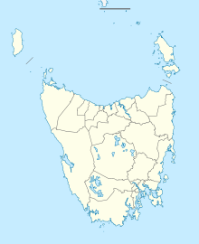
Burnie Airport Wynyard Airport | |||||||||||||||
|---|---|---|---|---|---|---|---|---|---|---|---|---|---|---|---|
 | |||||||||||||||
| Summary | |||||||||||||||
| Airport type | Public | ||||||||||||||
| Owner/Operator | Burnie Airport Corporation | ||||||||||||||
| Serves | Burnie, Tasmania | ||||||||||||||
| Location | Wynyard, Tasmania | ||||||||||||||
| Opened | 26 February 1934[1] | ||||||||||||||
| Elevation AMSL | 62 ft / 19 m | ||||||||||||||
| Coordinates | 40°59′56″S 145°43′52″E / 40.99889°S 145.73111°E | ||||||||||||||
| Website | www.burnieairport.com.au | ||||||||||||||
| Maps | |||||||||||||||
 | |||||||||||||||
 | |||||||||||||||
| Runways | |||||||||||||||
| |||||||||||||||
| Statistics (2016/17[2]) | |||||||||||||||
| |||||||||||||||
Burnie Airport (IATA: BWT, ICAO: YWYY), also called Burnie Wynyard Airport or Wynyard Airport, is a regional airport located adjacent to the town of Wynyard, about 17 kilometres (11 mi) west of Burnie, Tasmania, Australia. Formally named the Wynyard Aerodrome, the first official opening occurred on 26 February 1934. The Burnie Airport is majority owned by the Burnie City Council.
- ^ Cite error: The named reference
BurnieHistorywas invoked but never defined (see the help page). - ^ a b Cite error: The named reference
airportstatswas invoked but never defined (see the help page). - ^ YWYY – Wynyard (PDF). AIP En Route Supplement from Airservices Australia, effective 13 June 2024, Aeronautical Chart Archived 14 May 2016 at the Wayback Machine
