Bushrod | |
|---|---|
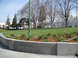
 Shattuck Avenue entrance to Bushrod Park | |
 Location of Bushrod Park in Oakland | |
| Coordinates: 37°50′45″N 122°15′49″W / 37.84576°N 122.26358°W | |
| Country | United States |
| State | California |
| County | Alameda |
| City | Oakland |
The Bushrod neighborhood in North Oakland, Oakland, California is an area surrounding its namesake park, and bounded by Martin Luther King, Jr. Way to the west, Claremont Avenue to the east, Highway 24 to the south, and the Berkeley border to the north.[1] It borders the neighborhoods of Santa Fe to the west, Fairview Park to the east, and Temescal and Shafter to the south and southeast, respectively. Notable landmarks include the Bushrod Park ballfields and the former Bushrod Washington Elementary School, which share adjoining land on a large greenbelt and open space in the heart of the neighborhood.
In 2017, the real estate firm Redfin name Bushrod the hottest neighborhood market in the United States based on traffic to its website by potential home buyers.[2]
- ^ "Neighborhood Search Map". Oakland Museum of California. Archived from the original on 2009-04-30. Retrieved 2011-07-29.
- ^ "Oakland's Bushrod neighborhood named nation's hottest housing market".