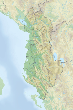
| Butrint Lagoon | |
|---|---|
 Panoramic view of Lake Butrint | |
| Location | Sarandë, Vlorë |
| Coordinates | 39°47′0″N 20°2′0″E / 39.78333°N 20.03333°E |
| Basin countries | Albania |
| Max. length | 7.1 km (4.4 mi) |
| Max. width | 3.3 km (2.1 mi) |
| Surface area | 16 km2 (6.2 sq mi)[1] |
| Average depth | 11.4 m (37 ft) |
| Max. depth | 24.4 m (80 ft) |
| Surface elevation | 1 m (3.3 ft) |
Butrint Lagoon (Albanian: Liqeni i Butrintit) is a salt lagoon south of Saranda, Albania, located in direct proximity of the Ionian Sea. It is surrounded by dense forested hills, rocky coast and complemented by saltwater and freshwater marshlands. The lake has a length of 7.1 km (4.4 mi) and a width of 3.3 km (2.1 mi), with a surface area of 16 km2 (6.18 sq mi).[2] The maximum depth of the lake is 24.4 m (80 ft).[3] At the south, the Vivari Channel connects the lagoon to the sea.
- ^ Ramsar Convention. "Information Sheet on Ramsar Wetlands (Ris): Butrint (Albania)" (PDF). rsis.ramsar.org. p. 3.
- ^ Ramsar Convention. "Information Sheet on Ramsar Wetlands (Ris): Butrint (Albania)" (PDF). rsis.ramsar.org. p. 3.
- ^ "Natural and human-induced environmental change in southern Albania for the last 300 years — Constraints from the Lake Butrint sedimentary record" (PDF). limnogeology.ethz.ch. p. 3.
Lake Butrint has an area of ~1600 ha and a mean water depth of 11.4 m, with a maximum of 21.4 m.
