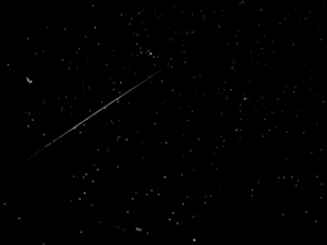
 A COSMO-SkyMed flare above the UK | |
| Manufacturer | Thales Alenia Space |
|---|---|
| Country of origin | Italy |
| Operator | ASI |
| Applications | Earth observation radar |
| Website | http://www.cosmo-skymed.it/it/index.htm |
| Specifications | |
| Bus | PRIMA |
| Launch mass | 1,700 kg (3,700 lb)[1] |
| Power | 4 kW |
| Regime | Sun-synchronous orbit |
| Design life | 5 years (planned) |
| Production | |
| Status | Operational |
| On order | 4 |
| Built | 4 |
| Launched | 4 |
| Operational | 4 |
| Maiden launch | COSMO-1 23 June 2007, 02:34:00 UTC |
| Last launch | COSMO-4 5 November 2010, 02:20:03 UTC |
| Manufacturer | Thales Alenia Space |
|---|---|
| Country of origin | Italy |
| Operator | ASI |
| Applications | Earth observation radar |
| Website | http://www.cosmo-skymed.it/it/index.htm |
| Specifications | |
| Bus | PRIMA |
| Launch mass | 2,205 kg (4,861 lb)[2] |
| Power | 5 kW |
| Regime | Sun-synchronous orbit |
| Design life | 7 years (planned) |
| Production | |
| Status | Operational |
| On order | 4 |
| Built | 2 |
| Launched | 2 |
| Operational | 1 |
| Maiden launch | CSG-1 18 December 2019, 08:54 UTC |
COSMO-SkyMed (COnstellation of small Satellites for the Mediterranean basin Observation) is an Earth-observation satellite space-based radar system funded by the Italian Ministry of Research and Ministry of Defence and conducted by the Italian Space Agency (ASI), intended for both military and civilian use.[3] The prime contractor for the spacecraft was Thales Alenia Space. COSMO SkyMed is a constellation of four dual use Intelligence, surveillance, target acquisition, and reconnaissance (ISR) Earth observation satellites with a synthetic-aperture radar (SAR) as main payload, the result of the intuition of Giorgio Perrotta in the early nineties. The synthetic-aperture radar was developed starting in the late nineties with the SAR 2000 program funded by ASI.
The space segment of the system includes four identical medium-sized 1,700 kg (3,700 lb) satellites called COSMO-SkyMed (or COSMO) 1, 2, 3, 4, equipped with synthetic-aperture radar (SAR) sensors with global coverage of the planet.[4] Observations of an area of interest can be repeated several times a day in all-weather conditions. The imagery is applied to defense and security assurance in Italy and other countries, seismic hazard analysis, environmental disaster monitoring, and agricultural mapping.[5]
- ^ "COSMO-SkyMed (Constellation of 4 SAR Satellites)". eoportal.org. Retrieved 26 November 2020.
- ^ "COSMO-SkyMed Second Generation (CSG) Constellation". eoportal.org. Retrieved 26 November 2020.
- ^ "COSMO-SkyMed: Mission definition and main applications and products" (PDF). ESA.
- ^ "COSMO-SkyMed". Telespazio. Archived from the original on 8 July 2007.
- ^ "SPACEHAB Subsidiary Signs New Contracts Totaling US$4.7 million". SPACEHAB.