Caddo County | |
|---|---|
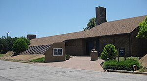
 The Southern Plains Indian Museum in Anadarko | |
 Location within the U.S. state of Oklahoma | |
 Oklahoma's location within the U.S. | |
| Coordinates: 35°11′N 98°23′W / 35.18°N 98.38°W | |
| Country | |
| State | |
| Founded | August 6, 1901 |
| Named for | Caddo Tribe |
| Seat | Anadarko |
| Largest city | Anadarko |
| Area | |
| • Total | 1,290 sq mi (3,300 km2) |
| • Land | 1,278 sq mi (3,310 km2) |
| • Water | 12 sq mi (30 km2) 0.9% |
| Population (2020) | |
| • Total | 26,945 |
| • Density | 21/sq mi (8.1/km2) |
| Time zone | UTC−6 (Central) |
| • Summer (DST) | UTC−5 (CDT) |
| Congressional district | 3rd |
Caddo County is a county located in the U.S. state of Oklahoma. As of the 2020 census, the population was 26,945.[1] Its county seat is Anadarko.[2] Created in 1901 as part of Oklahoma Territory, the county is named for the Caddo tribe who were settled here on a reservation in the 1870s. Caddo County is immediately west of the seven-county Greater Oklahoma City metro area, and although is not officially in the metro area, it has many economic ties in this region.
- ^ "Caddo County, Oklahoma". United States Census Bureau. Retrieved May 11, 2023.
- ^ "Find a County". National Association of Counties. Archived from the original on May 31, 2011. Retrieved June 7, 2011.