54°51′21″N 1°34′19″W / 54.855944°N 1.571972°W
This article has multiple issues. Please help improve it or discuss these issues on the talk page. (Learn how and when to remove these messages)
|
| Cade's Road | |
|---|---|
| Roman Road | |
 Roman Roads in Britain | |
| Route information | |
| Length | 100 mi (160 km) |
| Margary number | 80
( a ) -- Petuaria to Old Durham ( b ) -- Concangis to Pons Aelius |
| Major junctions | |
| From | Petuaria ( Brough, Humber Estuary ) |
| Derventio ( Stamford Bridge ),
(North-East)--Malton Roman Fort [a] (East)--Bridlington (West)--Eboracum ( York ) Lugunduno , River Tees (East)--Dunum Sinus, ( Tees Bay, North Sea ) (West)--Piercebridge Roman Fort (North-West)--Vinovia ( Binchester Roman Fort ) Old Durham, River Wear ( 80 b ) Concangis ( Chester-le-Street Roman Fort ) (North-East)--Arbeia ( South Shields Roman Fort ) | |
| To | Pons Aelius ( Newcastle Roman Fort ), River Tyne |
| Location | |
| Country | United Kingdom |
| Road network | |
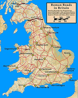
Cade's Road is a Roman Road in north-east England.[1] [2] It is named after John Cade of Durham, an 18th-century antiquarian who in 1785 proposed its existence and possible course from the Humber Estuary northwards to the River Tyne, a distance of about 100 miles (160 km). The road's Roman name is unknown. Although evidence exists for such a road on some parts of the proposed route, there is still some doubt regarding its exact course. [1] [3] [4]

Examples of place names with the suffix "le-Street" : [b]
Cite error: There are <ref group=lower-alpha> tags or {{efn}} templates on this page, but the references will not show without a {{reflist|group=lower-alpha}} template or {{notelist}} template (see the help page).
- ^ a b Selkirk 2001, pp. 212–217.
- ^ "MYO4439 – Roman Road". York Historic Environment Record. City of York Council. 3 November 2021.
- ^ *"Cade's Road : Stamford bridge to River Tees". Roads of Roman Britain. Retrieved 1 July 2022.
- ^ *"Cade's Road : River Tees to Durham". Bowburn Local History. Retrieved 1 July 2022.
- ^ "Key to English Place-Names : Chester-le-Street". University of Nottingham.
[for Chester-le-Street] : "Street" from strēt (Anglian), a Roman road
- ^
MAGiC MaP : Table of Contents
- Designations
- -- Listed Buildings (COLOURED SQUARE)
- -- Scheduled Monuments (SHADED POLYGON)
- OS Colour Mapping
- ^ "MAGiC MaP : Chester-le-Street". Natural England - Magic in the Cloud.
- ^ a b
MAGiC MaP : Table of Contents
- Administrative
- -- Parish Boundary (PURPLE LINE)
- OS Colour Mapping
- ^ "MAGiC MaP : Thornton le Street near Thirsk". Natural England - Magic in the Cloud.
- ^ "MAGiC MaP : Thorpe le Street near Pocklington". Natural England - Magic in the Cloud.
- ^ *Roman Britain (Historical Map and Guide). Ordnance Survey. 2010. ISBN 9780319290378.