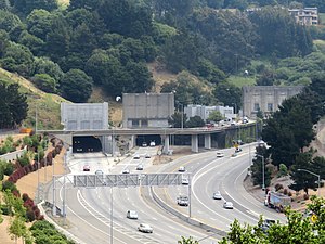
 The western end of the Caldecott Tunnel in 2019 | |
| Overview | |
|---|---|
| Location | Oakland / Contra Costa County, California |
| Coordinates | 37°51′17″N 122°13′00″W / 37.8548°N 122.2166°W |
| Route | |
| Crosses | Berkeley Hills |
| Start | Near Caldecott Lane |
| End | Fish Ranch Road |
| Operation | |
| Opened | Bores 1 & 2: 1937 Bore 3: 1964 Bore 4: 2013 |
| Operator | Caltrans |
| Technical | |
| Length | Bores 1 & 2: 3,610 ft (1,100 m) Bore 3: 3,771 ft (1,149 m) Bore 4: 3,389 ft (1,033 m) |
| No. of lanes | 2 per bore |
| Tunnel clearance | Bore 1: 14.58 feet (4.44 m) Bore 2: 14.5 feet (4.4 m) Bore 3: 15.5 feet (4.7 m) Bore 4: 15.5 feet (4.7 m) |
| Route map | |
 | |
| Designated | 1980 |
| Reference no. | 32 |
The Caldecott Tunnel is a four-bore highway tunnel through the Berkeley Hills between Oakland and Orinda, California. Its four bores carry California State Route 24. Named after Thomas E. Caldecott, former mayor of Berkeley, it opened in 1937 as a two-bore tunnel. The third bore opened in 1964 and the fourth bore in 2013. Currently, the two oldest bores carry eastbound traffic and the two newest bores carry westbound traffic.