Calstock
| |
|---|---|
| Village and civil parish | |
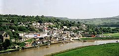
 Calstock village from the viaduct | |
Location within Cornwall | |
| Area | 23.79 km2 (9.19 sq mi) |
| Population | 6,253 2011 Census including Albaston , Dimson and Latchley[1] |
| • Density | 263/km2 (680/sq mi) |
| OS grid reference | SX4368 |
| • London | 191 Miles |
| Civil parish |
|
| Unitary authority | |
| Ceremonial county |
|
| Region | |
| Country | England |
| Sovereign state | United Kingdom |
| Post town | CALSTOCK |
| Postcode district | PL18 |
| Dialling code | 01822 |
| Police | Devon and Cornwall |
| Fire | Cornwall |
| Ambulance | South Western |
| UK Parliament | |
| Website | Calstock |
Calstock (Cornish: Kalstok[2]) is a civil parish and a large village in south east Cornwall, England, United Kingdom, on the border with Devon. The village is situated on the River Tamar 6 miles (9.7 km) south west of Tavistock and 10 miles (16 km) north of Plymouth.[3]
The parish had a population of 6,095 in the 2001 census.[4] This had increased to 6,431 at the 2011 census.[5] The parish encompasses 5,760 acres (23.3 km2) of land, 70 acres (0.28 km2) of water, and 44 acres (0.18 km2) of the tidal Tamar.[6]

As well as Calstock, other settlements in the parish include Albaston, Chilsworthy, Gunnislake, Harrowbarrow, Latchley, Metherell, Coxpark, Dimson, Drakewalls, Norris Green, Rising Sun and St Ann's Chapel.[7]
Calstock village is within the Tamar Valley AONB, is overlooked by Cotehele house and gardens, and lies on the scenic Tamar Valley railway. Calstock railway station opened on 2 March 1908. The village is twinned with Saint-Thuriau in Brittany, France.
- ^ Office for National Statistics Archived 8 January 2016 at the Wayback Machine 2011 census - Truro CP
- ^ "List of Place-names agreed by the MAGA Signage Panel" (PDF). Cornish Language Partnership. May 2014. Archived from the original (PDF) on 29 July 2014. Retrieved 11 January 2015.
- ^ Ordnance Survey: Landranger map sheet 201 Plymouth & Launceston ISBN 978-0-319-23146-3
- ^ Office for National Statistics & Cornwall County Council, 2001. Parish population statistics Archived 25 May 2006 at the Wayback Machine
- ^ "2011 census". Retrieved 6 February 2015.
- ^ Calstock Online Parish Clerk, 2005. Calstock Parish Archived 26 November 2005 at the Wayback Machine.
- ^ Cornwall; Explore Britain
