This article needs additional citations for verification. (February 2010) |
Calvinia
Kalvienieha in Afrikaans orthography | |
|---|---|
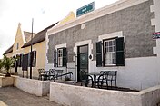
Top left: Hantam House Complex, right: Dutch Reformed Church, bottom left: Dorpshuis, right: Street in Calvinia | |
| Coordinates: 31°28′30″S 19°46′22″E / 31.47500°S 19.77278°E | |
| Country | South Africa |
| Province | Northern Cape |
| District | Namakwa |
| Municipality | Hantam |
| Established | 1851[1] |
| Named for | Jean Calvin |
| Area | |
| • Total | 132.61 km2 (51.20 sq mi) |
| Population (2011)[2] | |
| • Total | 2,855 |
| • Density | 22/km2 (56/sq mi) |
| Racial makeup (2011) | |
| • Coloured | 52.1% |
| • White | 39.6% |
| • Black African | 5.2% |
| • Indian/Asian | 1.2% |
| • Other | 1.9% |
| First languages (2011) | |
| • Afrikaans | 95.3% |
| • English | 2.4% |
| • Other | 2.3% |
| Time zone | UTC+2 (SAST) |
| Postal code (street) | 8190 |
| PO box | 8190 |
| Area code | 027 |
Calvinia is a regional town in the Northern Cape province of South Africa named after the French religious reformer Jean Calvin. The town falls under the Hantam Local Municipality which forms part of the Namakwa District Municipality. The Calvinia district is part of the Great Karoo region of South Africa. The town is just south of the Hantam mountains on the banks of the Oorlogskloof (meaning "War Ravine") River.
Calvinia enjoys 80% starlight and is renowned for its kaleidoscope of spring wildflowers coinciding with the Namaqualand wildflower spectacle.
An asteroid (1245 Calvinia) is named after the town.
- ^ Robson, Linda Gillian (2011). "Annexure A" (PDF). The Royal Engineers and settlement planning in the Cape Colony 1806–1872: Approach, methodology and impact (PhD thesis). University of Pretoria. pp. xlv–lii. hdl:2263/26503.
- ^ a b c d "Sub-Place Calvinia". Census 2011.


