Camas County | |
|---|---|
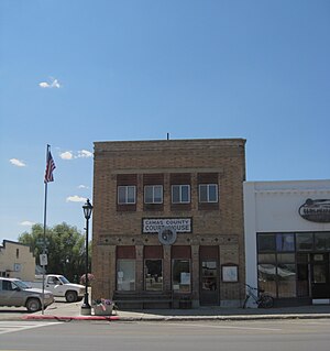
 Camas County Courthouse in Fairfield | |
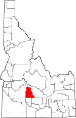
 Location within the U.S. state of Idaho | |
 Idaho's location within the U.S. | |
| Coordinates: 43°28′N 114°49′W / 43.47°N 114.81°W | |
| Country | |
| State | |
| Founded | February 6, 1917 |
| Named for | Camas root |
| Seat | Fairfield |
| Largest city | Fairfield |
| Area | |
| • Total | 1,079 sq mi (2,790 km2) |
| • Land | 1,074 sq mi (2,780 km2) |
| • Water | 4.5 sq mi (12 km2) 0.4% |
| Population (2020) | |
| • Total | 1,077 |
| • Estimate (2022) | 1,153 |
| • Density | 1/sq mi (0.4/km2) |
| Time zone | UTC−7 (Mountain) |
| • Summer (DST) | UTC−6 (MDT) |
| Congressional district | 2nd |
| Website | camascounty |
Camas County is a county in the southern portion of the U.S. state of Idaho. The county seat and largest city is Fairfield.[1] The county was established 107 years ago in 1917 by the Idaho Legislature with a partition of Blaine County on February 6. It is named for the camas root, or Camassia, a lily-like plant with an edible bulb found in the region, that Native Americans and settlers used as a food source. As of the 2020 census, the population was 1,077,[2] making it the second-least populous county in the state, after Clark County.
Camas County is part of the Hailey, ID Micropolitan Statistical Area.
- ^ "Find a County". National Association of Counties. Archived from the original on May 31, 2011. Retrieved June 7, 2011.
- ^ "State & County QuickFacts". United States Census Bureau. Retrieved January 16, 2024.