Cameron Highlands District | |
|---|---|
| Daerah Cameron Highlands | |
| Other transcription(s) | |
| • Malay | Tanah Tinggi Cameron (Rumi) تانه تيڠڬي كاميرون (Jawi) |
| • Chinese | 金马仑高原县 (Simplified) 金馬崙高原縣 (Traditional) Jīnmǎlún Gāoyuán xiàn (Hanyu Pinyin) Gam1 Maa5 Leon4 Gou1 Jyun4 Jyun2 (Jyutping) |
| • Tamil | கேமரன் மலை மாவட்டம் Kēmaraṉ Malai māvaṭṭam (Transliteration) |
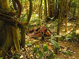
| Top down: Tea plantation • Rafflesia plant • Strawberries (left) • Black-throated sunbird (right) • All Souls' Church. | |
| Etymology: Named after William Cameron, a British explorer and geologist. | |
 Location of Cameron Highlands District in Pahang | |
 | |
Location of Cameron Highlands District in Malaysia | |
| Coordinates: 4°30′N 101°30′E / 4.500°N 101.500°E | |
| Country | |
| State | |
| Surveyed | 1885 by William Cameron |
| Seat | Tanah Rata |
| Local area government(s) | Cameron Highlands District Council |
| Government | |
| • President | Zainal-Abidin Amin[1] |
| Area (MDCH operation area)[2] | |
| • Total | 275.36 km2 (106.32 sq mi) |
| Population (2019[3]) | |
| • Total | 43,700 |
| • Density | 160/km2 (410/sq mi) |
| • Demonym | Cameron Highlander |
| Time zone | UTC+08:00 (MST) |
| Postcode | 39xxx |
| Calling code | +6-05 |
| Vehicle registration plates | C |
| Website | www |
The Cameron Highlands (Malay: Tanah Tinggi Cameron, Chinese: 金馬崙高原, Tamil: கேமரன் மலை) is a district in Pahang, Malaysia, occupying an area of 712.18 square kilometres (274.97 sq mi). To the north, its boundary touches that of Kelantan; to the west, it shares part of its border with Perak. Situated at the northwestern tip of Pahang, Cameron Highlands is approximately 90 kilometres (56 mi) east from Ipoh, roughly 200 kilometres (120 mi) north from Kuala Lumpur or about 355 kilometres (221 mi) from Kuantan, the capital of Pahang. It is the smallest municipality in the state.
Surveyed by the government geologist and explorer William Cameron[4][5] in 1885, the outpost consists of three mukims (subdistricts), namely Ringlet, Tanah Rata and Ulu Telom.[6] Its eight settlements are Ringlet, Tanah Rata (the administrative centre), Brinchang, the Bertam Valley, Kea Farm, Tringkap, Kampung Kuala Terla, Kampung Raja and Blue Valley. All are nestled at elevations ranging from 800 metres (2,600 ft) to 1,603 metres (5,259 ft) above sea level.[7]
Developed in the 1930s, the tableland is one of the oldest tourist spots in Malaysia. Apart from its tea estates,[8] the plateau is noted for its cool weather, orchards, nurseries, farmlands, waterfalls, rivers, lakes, wildlife, mossy forest, golf course, hotels, places of worship, bungalows, Land Rovers, museum and native inhabitants (Orang Asli).
- ^ primuscoreadmin (16 October 2015). "Profil YDP".
- ^ primuscoreadmin (16 October 2015). "Latar Belakang".
- ^ Based on the data from the Department of Statistics
- ^ Straits Times Weekly Issue, 22 November 1886, Page 1
- ^ Barr, Pat (1977). Taming the jungle. Martin Secker & Warburg Limited. p. 72. ISBN 0-436-03365-8.
- ^ "Ringkasan Eksekutif RT Cameron Highlands 2030" (PDF) (in Malay). Archived from the original (PDF) on 2017-12-22. Retrieved 2017-12-22.
- ^ "Geological terrain mapping in Cameron Highlands district, Pahang 2003" (PDF). Archived from the original (PDF) on 2022-03-30. Retrieved 2018-04-21.
- ^ Moore, Wendy Khadijah (2004). Malaysia: A Pictorial History 1400–2004. Archipelago Press. p. 182. ISBN 981-4068-77-2.


