 Six Foot Lake, on Campbell Island / Motu Ihupuku | |
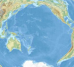
 Map of Campbell Island / Motu Ihupuku | |
| Etymology | Robert Campbell |
|---|---|
| Geography | |
| Location | Pacific Ocean |
| Coordinates | 52°32′24″S 169°8′42″E / 52.54000°S 169.14500°E |
| Archipelago | Campbell Islands |
| Area | 112.68 km2 (43.51 sq mi) |
| Highest elevation | 569 m (1867 ft) |
| Highest point | Mount Honey |
| Administration | |
New Zealand | |
| Demographics | |
| Population | 0 |
| Additional information | |
| Time zone | |
| • Summer (DST) | |
| UN/LOCODE: TF | |
Campbell Island / Motu Ihupuku is an uninhabited subantarctic island of New Zealand, and the main island of the Campbell Island group. It covers 112.68 square kilometres (43.51 sq mi) of the group's 113.31 km2 (43.75 sq mi), and is surrounded by numerous stacks, rocks and islets like Dent Island, Folly Island (or Folly Islands), Isle de Jeanette-Marie, and Jacquemart Island, the latter being the southernmost extremity of New Zealand. The island is mountainous, rising to over 500 metres (1,640 ft) in the south. A long fiord, Perseverance Harbour, nearly bisects it, opening out to sea on the east coast.
The island is listed with the New Zealand Outlying Islands. The island is an immediate part of New Zealand, but not part of any region or district, but instead Area Outside Territorial Authority, like all other outlying islands, other than the Solander Islands. It is the closest piece of land to the antipodal point of the United Kingdom and Ireland, and the city furthest away is Limerick, Ireland.[citation needed]
Campbell Island is a UNESCO World Heritage Site.
