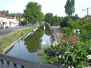
| Canal du Centre | |
|---|---|
 Canal du Centre in Paray-le-Monial. | |
| Specifications | |
| Length | 112.1 km (69.7 mi) |
| Locks | 61 (originally 80) |
| History | |
| Former names | Canal du Charollais |
| Principal engineer | Émiland Gauthey |
| Date approved | 1783 |
| Construction began | 1784 |
| Date of first use | 1792 |
| Date completed | 1792 |
| Geography | |
| Start point | Digoin |
| End point | Chalon-sur-Saône |
| Beginning coordinates | 46°28′39″N 3°58′50″E / 46.47756°N 3.98053°E at aqueduct crossing Loire in Digoin |
| Ending coordinates | 46°47′53″N 4°52′48″E / 46.79812°N 4.88008°E |
| Branch of | Bourbonnais route |
| Connects to | Canal latéral à la Loire at Digoin, Saône at Chalon-sur-Saône |
 | |
The Canal du Centre (French pronunciation: [kanal dy sɑ̃tʁ]), originally known as the Canal du Charollais (French pronunciation: [kanal dy ʃaʁɔlɛ]), is a French canal running from Digoin, where it now joins the Canal latéral à la Loire, to the Saône at Chalon-sur-Saône. It was opened in 1792 and was the first watershed canal allowing boats to pass from the north of France to the south. It is 112.1 kilometres (69.7 mi) long and has 61 locks. Most of its traffic was generated by now abandoned coal mines at Montceau-les-Mines.
