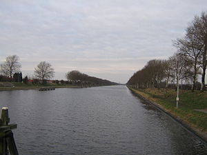
| Canal through Walcheren | |
|---|---|
 Looking toward Middelburg from a bridge at Souburg. | |
 | |
| Country | The Netherlands |
| Specifications | |
| Length | 16 kilometres (9.9 miles; 8.6 nautical miles) |
| Lock length | 140.7 m (462 ft) [1] |
| Lock width | 23.4 m (77 ft) |
| Maximum boat length | 130 m (427 ft) [2] |
| Maximum boat beam | 18 m (59.1 ft) |
| Maximum boat draft | 4.5 m (14.8 ft) |
| Maximum boat air draft | no limit |
| Original number of locks | 2 x 2 + safety lock gates |
| Status | operational |
| Navigation authority | Province Zeeland |
| History | |
| Construction began | 1870 |
| Date completed | 1873 |
| Geography | |
| Start point | Veerse Meer at Veere |
| End point | Western Scheldt at Vlissingen |
| Beginning coordinates | 51°32′51.6″N 3°40′20″E / 51.547667°N 3.67222°E |
| Ending coordinates | 51°26′20″N 3°36′11″E / 51.43889°N 3.60306°E |
| Branch(es) | Arnekanaal, Middelburg harbour |
| Connects to | Arnemuiden and Nieuw- en Sint Joosland |
 | |
The Canal through Walcheren in the Netherlands crosses the east of Walcheren. It connects the Westerschelde and the Veerse Meer.