| Candy Mountain | |
|---|---|
 View from Candy Mountain Summit showing Red Mountain and Rattlesnake Mountain to the north west. | |
| Highest point | |
| Elevation | 1,394 ft (425 m) NAVD 88[1] |
| Prominence | 536 ft (163 m)[1] |
| Isolation | 2.76 mi (4.44 km)[1] |
| Coordinates | 46°15′33″N 119°22′00″W / 46.259115°N 119.366603°W[1] |
| Geography | |
| Parent range | Columbia River Plateau |
| Topo map | USGS Richland |
| Climbing | |
| Easiest route | Hike |
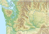
Candy Mountain is a small mountain located just outside West Richland, Washington. Candy Mountain rises above the Tri-Cities, located between Badger Mountain to the south and Red Mountain to the north.
Candy Mountain is connected to Badger Mountain by Goose Gap.[2] There is a primitive road leading to the top, and the remains of an old radio tower.[3] The non-profit organization Friends of Badger Mountain, in collaboration with Benton County, raised funds and pursued grants to purchase 200 acres of land surrounding Candy Mountain to build new trails on the mountain and connect it to Badger Mountain.[4]
- ^ a b c d "Candy Mountain, Washington". Peakbagger.com. Retrieved 2015-08-31.
- ^ "Goose Gap". Geographic Names Information System. United States Geological Survey, United States Department of the Interior. Retrieved 2015-08-31.
- ^ Candy Mountain Hiking Trail Archived 2015-09-05 at the Wayback Machine Accessed 2015-08-31
- ^ Candy Mountain dream about to come true Archived 2017-09-04 at the Wayback Machine Accessed 2017-05-20
