Canela | |
|---|---|
| Municipality of Canela | |
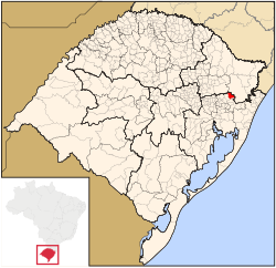
 Location in the state of Rio Grande do Sul and Brazil | |
| Coordinates: 29°21′42″S 50°48′56″W / 29.36167°S 50.81556°W | |
| Country | |
| Region | South |
| State | |
| Founded | December 28, 1944 |
| Government | |
| • Mayor | Constantino Orsolin |
| Area | |
| • Total | 254.579 km2 (98.294 sq mi) |
| Elevation | 837 m (2,746 ft) |
| Population (2020 [1]) | |
| • Total | 45,488 |
| • Density | 157.7/km2 (408/sq mi) |
| Time zone | UTC−3 (BRT) |
| HDI (2010) | 0.748 – high[2] |
| Website | www |
Canela (Portuguese pronunciation: [kɐˈnɛlɐ]), meaning Cinnamon in Portuguese, is a town located in the Serra Gaúcha of Rio Grande do Sul, Brazil. Both Canela and neighboring Gramado are important tourist locations and they both draw many visitors each year. Ecotourism is very popular in the area and there are many opportunities for hiking, rock climbing, horseback riding and river rafting.
- ^ IBGE 2020
- ^ "Archived copy" (PDF). United Nations Development Programme (UNDP). Archived from the original (PDF) on July 8, 2014. Retrieved August 1, 2013.
{{cite web}}: CS1 maint: archived copy as title (link)


