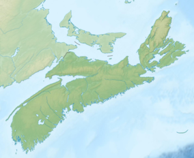
| Cape Breton Highlands National Park | |
|---|---|
| Parc national des Hautes-Terres-du-Cap-Breton | |
 Autumn colours in the park | |
| Location | Ingonish, Nova Scotia, Canada |
| Coordinates | 46°44′00″N 60°38′30″W / 46.73333°N 60.64167°W |
| Area | 949 km2 (366 sq mi) |
| Established | 1936 |
| Visitors | 277,203[1] (in 2022–23) |
| Governing body | Parks Canada |
| Website | http://www.pc.gc.ca/en/pn-np/ns/cbreton/ |
 | |

Cape Breton Highlands National Park is a Canadian national park on northern Cape Breton Island in Nova Scotia.[2] The park was the first national park in the Atlantic provinces of Canada[3] and covers an area of 948 square kilometres (366 sq mi).[4] It is one of 42 in Canada's system of national parks.
It consists of mountains, valleys, waterfalls, rocky coastlines and the Cape Breton Highlands, a tundra-esque plateau. Forest types include Acadian and Boreal. The park includes the highest point in Nova Scotia, White Hill, at 533.5 m (1,750 ft) above sea level.
Rivers in the park include the Chéticamp River and the North Aspy River.
In 2014, Parks Canada started a four-year project with the Unama'ki Institute of Natural Resources, among other partners, to begin regional boreal forest restorations within this park.
- ^ Canada, Parks. "Parks Canada attendance 2022_23 - Parks Canada attendance 2022_23 - Open Government Portal". open.canada.ca. Retrieved 2024-05-07.
- ^ "Geographical Names of Canada - Cape Breton Highlands National Park of Canada". Government of Canada. Retrieved 16 June 2018.
- ^ "Cape Breton Highlands National Park, Cabot Trail". Archived from the original on 2000-04-13. Retrieved 2011-03-29.
- ^ Finkelstein, Maxwell W. (9 February 2010). "Cape Breton Highlands National Park". The Canadian Encyclopedia. Historica Canada. Archived from the original on 11 January 2018. Retrieved 29 March 2011.

