You can help expand this article with text translated from the corresponding article in Portuguese. (March 2016) Click [show] for important translation instructions.
|
Caratinga | |
|---|---|
| Municipality of Caratinga | |
 | |
| Coordinates: 19°37′30″S 42°09′00″W / 19.62500°S 42.15000°W | |
| Country | |
| Region | Southeast |
| State | |
| Founded | June 24, 1892 |
| Government | |
| • Mayor | João Bosco Pessine Gonçalves |
| Area | |
| • Total | 1,251 km2 (483 sq mi) |
| Elevation | 578 m (1,896 ft) |
| Population (2020 [1]) | |
| • Total | 92,603 |
| Time zone | UTC−3 (BRT) |
| HDI (2010) | 0.706 – high[2] |
| Website | www |

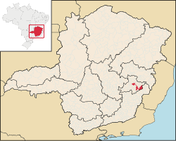
Caratinga is a municipality in eastern Minas Gerais state, Brazil. The population in 2020 was 92,603 inhabitants and the total area of the municipality was 1,251 km2. The elevation is 578 meters above sea level, with maximum elevation of 1,516 m in the Serra do Rio Preto and 330 m at the mouth of the Córrego Boachá.
- ^ [ IBGE 2020]
- ^ "Archived copy" (PDF). United Nations Development Programme (UNDP). Archived from the original (PDF) on July 8, 2014. Retrieved August 1, 2013.
{{cite web}}: CS1 maint: archived copy as title (link)


