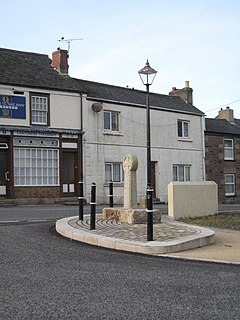
Carharrack
| |
|---|---|
 Carharrack | |
Location within Cornwall | |
| Population | 1,348 (2011 census)[1] |
| OS grid reference | SW732414 |
| Civil parish |
|
| Unitary authority | |
| Ceremonial county | |
| Region | |
| Country | England |
| Sovereign state | United Kingdom |
| Post town | REDRUTH |
| Postcode district | TR16 |
| Dialling code | 01209 |
| Police | Devon and Cornwall |
| Fire | Cornwall |
| Ambulance | South Western |
| UK Parliament | |


Carharrack (Cornish: Karardhek) is a civil parish and village in west Cornwall, England, United Kingdom. It is situated two miles (3 km) east of Redruth[2] in a former mining area.
The parish is of a rural/residential character, albeit with an industrial (mostly mining) past and relics of the past abound, primarily in the form of abandoned and broken down engine house buildings. The parish is comparatively small in area, and is bounded to the north and northwest by St Day parish, to the east and southeast by Gwennap parish, and to the southwest and west by Lanner parish.[3]
Until 1985, Carharrack was part of the parish of Gwennap but it became a civil parish in its own right with the first meeting of Carharrack Parish Council on 28 May 1985.[4]
- ^ "Civil Parish population 2011". Neighbourhood Statistics. Office for National Statistics. Retrieved 27 February 2017.
- ^ Ordnance Survey: Landranger map sheet 204 Truro & Falmouth ISBN 978-0-319-23149-4
- ^ "Cornwall Council interactive mapping". Archived from the original on 5 May 2010. Retrieved 13 September 2010. Cornwall Council mapping. Retrieved May 2010
- ^ [1] GENUKI website: Gwennap. Retrieved may 2010
