Carmacks | |
|---|---|
 Carmacks is seen from the Yukon River bridge with the river in the foreground. | |
| Coordinates: 62°05′20″N 136°17′20″W / 62.08889°N 136.28889°W | |
| Country | Canada |
| Territory | Yukon |
| Area | |
| • Land | 36.87 km2 (14.24 sq mi) |
| Population (2021)[1] | |
| • Total | 588 |
| • Density | 13.3/km2 (34/sq mi) |
| • DPL[2] | 206 |
| Time zone | UTC−07:00 (MST) |
| Climate | Dsc |
| Website | Official website |
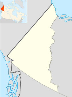
Carmacks is a village in Yukon, Canada, on the Yukon River along the Klondike Highway, and at the west end of the Robert Campbell Highway from Watson Lake. The population is 588 (Canada Census, 2021), an increase from the Census of 2016. It is the home of the Little Salmon/Carmacks First Nation, a Northern Tutchone-speaking people.

