| Carp Hills | |
|---|---|
| Carp Ridge | |
 | |
| Highest point | |
| Elevation | 129 m (423 ft)[1] |
| Dimensions | |
| Area | 4,000 ha (10,000 acres)[2] |
| Geography | |
| Country | Canada |
| Province | Ontario |
| City | Ottawa |
| Range coordinates | 45°22′50″N 76°04′07″W / 45.3806°N 76.0686°W |
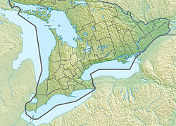
The Carp Hills (also known as Carp Ridge[3]) are a small range of rocky hills between the shallow valleys of the Carp River and Constance Creek, entirely within the West Carleton-March Ward of Canada's capital, Ottawa, Ontario. It runs roughly from Kinburn Side Road southeast to the village of Carp and the South March Highlands at March Road.[3]
The hills cover roughly 4,000 hectares (10,000 acres)[2] and are mostly undeveloped. The ridge is an extension of the Canadian Shield, with a landscape that is characterized by a mix of rocky outcrops, grassland, marshes, numerous shallow ponds, and patches of mature forest. Its pristine rugged nature has been compared to the nearby Gatineau Park and is regarded as an "ecological jewel".[3][2][4]
The Carp Ridge is used for hiking, hunting, cross-country skiing, and snowmobiling.[5] Among the few walking and hiking trails on the ridge are the Carp Barrens Trail, a 3-kilometre (1.9 mi) trail south of Thomas Dolan Parkway, the Crazy Horse trail, a 6.2-kilometre (3.9 mi) loop trail starting at March Road, and pathways at Hidden Lake Park in the village of Carp.[6]
- ^ Cite error: The named reference
ANSIwas invoked but never defined (see the help page). - ^ a b c "Conserving habitat at Ottawa's Carp Hills". ducks.ca. Ducks Unlimited Canada. Archived from the original on August 12, 2019. Retrieved July 30, 2019.
- ^ a b c "Preserving the Carp Hills". Friends of the Carp River. 2014. Archived from the original on July 15, 2016. Retrieved July 17, 2019.
- ^ "The Great Ottawa Outdoors Just Got Better". www.ducks.ca. Ducks Unlimited Canada. April 23, 2018. Archived from the original on August 12, 2019. Retrieved July 30, 2019.
- ^ "Preserving the Carp Hills". Mississippi Madawaska Land Trust. Archived from the original on August 12, 2019. Retrieved July 30, 2019.
- ^ "Crazy Horse Trail". carphills.com. Friends of the Carp Hills. Archived from the original on August 12, 2019. Retrieved August 14, 2019.
