| Carrawburgh | |
|---|---|
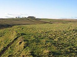
 Southern rampart of Brocolitia | |
| Alternative name(s) | Brocolitia, Procolita, or Brocolita |
| Place in the Roman world | |
| Province | Britannia |
| Stationed military units | |
| — Cohorts — | |
| I Aquitanorum, I Tungrorum, I Cugernorum, I Batavorum equitata, I Frisiavonum | |
| Location | |
| Coordinates | 55°02′10″N 2°13′23″W / 55.036°N 2.223°W |
| County | Northumberland |
| Country | England |
| Reference | |
| UK-OSNG reference | NY858712 |
| Site notes | |
| Controlled by | English Heritage |


Carrawburgh is a settlement in Northumberland.[1] In Roman times, it was the site of a 3+1⁄2-acre (1.5 ha) auxiliary fort on Hadrian's Wall called Brocolitia, Procolita, or Brocolita.
The name "Procolita" is found in the 5th-century document, the Notitia Dignitatum, and "Brocoliti" in the 7th-century Ravenna Cosmography. The name is probably based on the Celtic name for the place, and one possible translation put forward is 'badger holes'.
- ^ Esmonde Cleary, A. "Places: 89128 (*Brocolitia)". Pleiades. Retrieved 28 July 2016.
