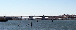
Casco Bay Bridge | |
|---|---|
 | |
| Coordinates | 43°38′41″N 70°15′24″W / 43.644647°N 70.25656°W |
| Carries | Motor vehicles and pedestrians |
| Crosses | Fore River |
| Locale | Portland, Maine |
| Characteristics | |
| Design | Multi-Girder Bascule |
| Total length | 4,748 feet (1447.2 m) |
| Longest span | 285 feet (86.9 m) at movable span |
| Clearance below | 65 feet (19.8 m) |
| History | |
| Opened | August 1997 |
| Statistics | |
| Daily traffic | 32,000+ vehicles per day |
| Location | |
 | |
The Casco Bay Bridge is a bascule bridge that spans the Fore River, connecting South Portland and Portland, Maine, United States. The bridge carries four lanes (two in each direction) of State Route 77, a bike lane in each direction, and a pedestrian sidewalk on the east side of the span.