| Catalan Bay | |
|---|---|
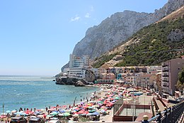
 View of Catalan Bay looking South | |
 Click on the map for a fullscreen view | |
| Location | |
| Country | Gibraltar |
| Location | Gibraltar |
| Coordinates | 36°08′20″N 5°20′29″W / 36.13875°N 5.34128°W |
| Details | |
| Owned by | Government of Gibraltar |
| Type of harbour | Natural |


Catalan Bay (Spanish: La Caleta) is a bay and fishing village in Gibraltar, on the eastern side of The Rock away from Westside.