| Cedar Creek | |
|---|---|
 Cedar Creek, adjacent the Cedar Creek Trail | |
| Location | |
| Country | United States |
| State | Virginia |
| Counties | Rockbridge County, Botetourt County |
| Physical characteristics | |
| Source | |
| • location | Short Hills Wildlife Management Area, Botetourt County |
| • coordinates | 37°37′36″N 79°38′22″W / 37.62667°N 79.63944°W[1] |
| Mouth | James River |
• location | Gilmore Mills, Rockbridge County |
• coordinates | 37°36′29″N 79°32′33″W / 37.60806°N 79.54250°W[1] |
| Length | 12.0 mi (19.3 km) |
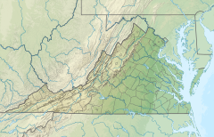
Cedar Creek is a 12.0-mile-long (19.3 km)[2] tributary of the James River in the U.S. state of Virginia. It is notable for flowing through the Natural Bridge rock formation, a National Historic Landmark.
- ^ a b "Cedar Creek". Geographic Names Information System. United States Geological Survey, United States Department of the Interior. Retrieved January 1, 2017.
- ^ U.S. Geological Survey. National Hydrography Dataset high-resolution flowline data. The National Map Archived 2012-03-29 at the Wayback Machine, accessed April 1, 2011

