| Central Coast Council New South Wales | |||||||||||||||
|---|---|---|---|---|---|---|---|---|---|---|---|---|---|---|---|
 Location in New South Wales | |||||||||||||||
| Coordinates | 33°25′S 151°20′E / 33.417°S 151.333°E | ||||||||||||||
| Population | 346,596 (2021 census)[1] | ||||||||||||||
| • Density | 206.18/km2 (534.02/sq mi) | ||||||||||||||
| Established | 12 May 2016 | ||||||||||||||
| Area | 1,681 km2 (649.0 sq mi)[2] | ||||||||||||||
| Time zone | AEST (UTC+10) | ||||||||||||||
| • Summer (DST) | AEDT (UTC+11) | ||||||||||||||
| Mayor | Lawrie McKinna (Independent) | ||||||||||||||
| Council seat | Gosford and Wyong | ||||||||||||||
| Region | Central Coast | ||||||||||||||
| State electorate(s) | |||||||||||||||
| Federal division(s) | |||||||||||||||
 | |||||||||||||||
| Website | Central Coast Council | ||||||||||||||
| |||||||||||||||
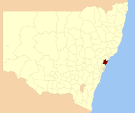
The Central Coast Council is a local government area in the Central Coast region of New South Wales, Australia. It is adjacent to the Pacific Highway, Central Coast Highway, the Northern railway line and the Pacific Ocean. The council was formed on 12 May 2016 following the merger of the City of Gosford and Wyong Shire Councils.[2]
The council comprises an area of 1,681 square kilometres (649 sq mi) and is bounded to the east by the Tasman Sea, to the south by Broken Bay and the Hawkesbury River, and to the west by the Yengo National Park northwards to Bucketty before heading eastward along George Downes Drive, encompassing the Olney State Forest and crossing the Pacific Motorway, meeting the southern edge of Lake Macquarie at Mannering Park and eventually reaching the coast north of Moonee. The Central Coast Council has over 40 beaches and over 90 kilometres (56 mi) of coastline. As at the 2021 census the council area had an estimated population of 346,596.[1]
The Mayor of the Central Coast Council is Cr. Lawrie McKinna who is part of the Independent Team Central Coast political party since 8 October 2024, and the Deputy Mayor of the council is Cr. Douglas Eaton who is part of the Independent Liberal political party since 8 October 2024.[3]
- ^ a b Australian Bureau of Statistics (28 June 2022). "Central Coast (NSW)". 2021 Census QuickStats. Retrieved 6 February 2024.
- ^ a b "Central Coast Council". Stronger Councils. Government of New South Wales. 12 May 2016. Archived from the original on 8 June 2018. Retrieved 14 May 2016.
- ^ "Central Coast Council Elects new Mayor and Deputy Mayor". 8 October 2024. Retrieved 23 October 2024.