| Cerro La Santa | |
|---|---|
 Cerro La Santa from Borinquen, Caguas | |
| Highest point | |
| Elevation | 2,962 ft (903 m) |
| Prominence | 75 ft (23 m) |
| Isolation | 17.83 mi (28.69 km) |
| Coordinates | 18°06′48″N 66°03′09″W / 18.11333°N 66.05250°W |
| Naming | |
| Etymology | "hill of the saint" or "hill of the holy woman" in Spanish |
| Geography | |
| Parent range | Sierra de Cayey |
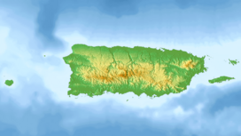
Cerro La Santa is a 2,962 feet (903 m) high mountain and the highest point in the Sierra de Cayey in Puerto Rico. The peak of Cerro La Santa is located in the Carite State Forest, at a tri-point shared by the municipalities of Caguas (San Salvador), Cayey (Farallón) and San Lorenzo (Espino).[1]
- ^ "Cerro La Santa - Peakbagger.com". www.peakbagger.com. Retrieved 2022-01-12.
