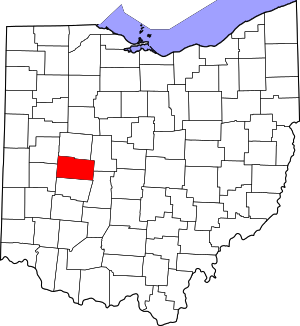
Champaign County | |
|---|---|
 Champaign County Courthouse in Urbana | |
 Location within the U.S. state of Ohio | |
 Ohio's location within the U.S. | |
| Coordinates: 40°08′N 83°46′W / 40.14°N 83.77°W | |
| Country | |
| State | |
| Founded | March 1, 1805[1] |
| Named for | "plain" in French |
| Seat | Urbana |
| Largest city | Urbana |
| Area | |
| • Total | 430 sq mi (1,100 km2) |
| • Land | 429 sq mi (1,110 km2) |
| • Water | 1.2 sq mi (3 km2) 0.3% |
| Population (2020) | |
| • Total | 38,714 |
| • Density | 90/sq mi (35/km2) |
| Time zone | UTC−5 (Eastern) |
| • Summer (DST) | UTC−4 (EDT) |
| Congressional district | 4th |
| Website | www |
Champaign County is a county located in the U.S. state of Ohio. As of the 2020 census, the population was 38,714.[2] Its county seat and largest city is Urbana.[3] The county takes its name from the French word for "open level country".[4] Champaign County became the 18th of 88 Ohio counties on March 1, 1805. It was formed from parts of Greene and Franklin counties by legislative action.[5] Champaign County comprises the Urbana, OH Micropolitan Statistical Area, which is also included in the Dayton–Springfield–Sidney, OH Combined Statistical Area.
- ^ "Ohio County Profiles: Champaign County" (PDF). Ohio Department of Development. Archived from the original (PDF) on June 21, 2007. Retrieved April 28, 2007.
- ^ 2020 census
- ^ "Find a County". National Association of Counties. Archived from the original on May 31, 2011. Retrieved June 7, 2011.
- ^ "Agriculture & Natural Resources in Champaign County". Ohio State University Extension. Archived from the original on July 16, 2011. Retrieved September 23, 2010.
- ^ The History of Champaign County, Ohio. W. H. Beers & Co. 1881.

