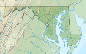
| Chapel Point State Park | |
|---|---|
 | |
| Location | Charles County, Maryland, United States |
| Nearest town | La Plata, Maryland |
| Coordinates | 38°28′09″N 77°00′50″W / 38.46917°N 77.01389°W[1] |
| Area | 821 acres (332 ha)[2] |
| Elevation | 138 ft (42 m)[1] |
| Designation | Maryland state park <! |
| Established | 1972 |
| Administrator | Maryland Department of Natural Resources |
| Website | Chapel Point State Park |
Chapel Point State Park is an undeveloped public recreation area located on the Port Tobacco River, a tributary of the Potomac, in Charles County, Maryland.[3] The state park offers fishing and hunting. Adjacent to the park, St. Ignatius Church and cemetery, the oldest continuous Roman Catholic parish in the United States, offers a scenic river view.
- ^ a b "Chapel Point State Park". Geographic Names Information System. United States Geological Survey, United States Department of the Interior.
- ^ Cite error: The named reference
acreagereportwas invoked but never defined (see the help page). - ^ Cite error: The named reference
mdnrwas invoked but never defined (see the help page).
