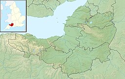
| Cheddar Reservoir | |
|---|---|
 at dusk looking towards the western edge of the Mendip Hills and Crook Peak | |
| Location | Somerset |
| Coordinates | 51°16′50″N 2°48′5″W / 51.28056°N 2.80139°W |
| Type | reservoir |
| Primary inflows | inlet from Cheddar Yeo |
| Basin countries | United Kingdom |
| Surface area | 105.4 ha (260 acres) |
| Site of Special Scientific Interest | |
 | |
| Location | Somerset |
|---|---|
| Grid reference | ST441537 |
| Coordinates | 51°16′50″N 2°48′05″W / 51.2806°N 2.8014°W |
| Interest | Biological |
| Area | 105.4 hectares (1.054 km2; 0.407 sq mi) |
| Notification | 1972 |
| Natural England website | |
Cheddar Reservoir is an artificial reservoir in Somerset, England, operated by Bristol Water. Dating from the 1930s it has a capacity of 1350 million gallons (6,140,000 cubic metres). The reservoir is supplied with water taken from the Cheddar Yeo river in Cheddar Gorge. The inlet grate for the 54 inches (1.4 m) water pipe that is used to transport the water can be seen immediately upstream from the sensory garden in Cheddar Gorge. It lies to the west of the village of Cheddar and south east of the town of Axbridge. Because of this it is sometimes known as Axbridge Reservoir. It is roughly circular in shape, and surrounded by large earth banks which are grazed by sheep.

