Chentangzhuang Subdistrict
陈塘庄街道 | |
|---|---|
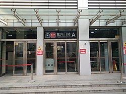
 Fuxingmen Station on the northeast of the subdistrict, 2020 | |
 Location in Hexi District | |
| Coordinates: 39°04′17″N 117°15′06″E / 39.07139°N 117.25167°E | |
| Country | China |
| Municipality | Tianjin |
| District | Hexi |
| Village-level Divisions | 14 communities |
| Area | |
| • Total | 5.6 km2 (2.2 sq mi) |
| Elevation | 6 m (20 ft) |
| Population (2010) | |
| • Total | 59,256 |
| • Density | 11,000/km2 (27,000/sq mi) |
| Time zone | UTC+8 (China Standard) |
| Postal code | 300202 |
| Area code | 022 |
Chentangzhuang Subdistrict (simplified Chinese: 陈塘庄街道; traditional Chinese: 陳塘莊街道; pinyin: Chéntángzhuāng Jiēdào) is a subdistrict situated on the east of Hexi District, Tianjin, China. It borders Fumin Road and Wanxin Subdistricts in the northeast, Liulin Subdistrict in the east, Shuanglin Farm and Donghai Subdistrict in the south, as well as Jianshan and Guajiasi Subdistricts in the west. It had 59,256 people residing under its administration in 2010.[1]
The subdistrict was created in 1954, and it incorporated Xiaohaidi Subdistrict in 2000.[2] The name Chentangzhuang literally means "Chen Pond Villa".
- ^ "China: Tiānjīn Municipal Province (Districts and Townships) - Population Statistics, Charts and Map". www.citypopulation.de. Retrieved 2022-11-05.
- ^ 中华人民共和国政区大典:天津市卷 (in Chinese). 中国社会出版社. 2020.

